Australia may be known for its beautiful beaches, but it also has stunning lakes strewn across every state.
From crystal clear and dazzling blue to pink-hued waters, these 8 gorgeous Australian lakes are the perfect backdrop for your next picnic.

Blue Lake, Mount Gambier SA
Mount Gambier’s Blue Lake sits within the crater of an extinct volcano that last erupted 5000 years ago. True to its name, the lake is a vibrant cobalt blue in the sunny months of December through to March. Almost overnight, as the season changes in April, the Blue Lake transforms, its waters turning a darker, grey steel colour. This hue change is due to microscopic calcite crystals scattering the light as it hits the water’s surface.
It may be tempting to hop in for a swim, but this is the town’s water source, so swimming is forbidden. Instead visitors can marvel at one of the most picturesque Australian lakes from the Blue Lake Circuit, a 3.6-kilometre walking track around its circumference. This walk provides gorgeous views from all 360 degrees, with sights of Mount Schank. For a more guided trip, book a 45-minute tour with Aquifer Tours. Learn fascinating insights into the hydrology of Mount Gambier’s water supply and aquifer system, and experience the majestic Blue Lake at close proximity in a glass-panelled lift that goes down the original well shaft used to extract water.
southaustralia.com.au/blue-lake

Lake McKenzie, K’gari (Fraser Island) QLD
On Fraser Island, 100 metres above sea level, sits the brilliant freshwater Lake McKenzie. It’s easily one of the most photographed Australian lakes, plastered all over social media year round. It is what’s known as a perched lake; its elevation is high enough above the water table that it’s made up purely of rainwater. The water is exceptionally clear, because its only pollutants are sunscreen and lotions that rub off swimmers. High acidity levels make it nearly impossible for any organic matter to survive; bar a few Fraser Island short-neck turtles and the odd fish. Beautiful to look at and so soft to walk on, the impressive pure white silica sand acts as a filter for the water, enhancing its clarity.
The island is filled with many walking trails alongside the 90-kilometre (one way) Fraser Island Great Walk. On these paths, hikers will experience amazing scenery from towering rainforests to vast sand dunes. For a longer stay, there are many four-wheel drive-accessible campgrounds around Fraser Island’s various landscapes. These include Central Station in the rainforest, Dundubara set behind the dunes, and Waddy Point Beachfront on the north-east coast.
visitfrasercoast.com.au/lake-mckenzie

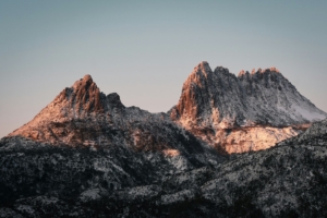
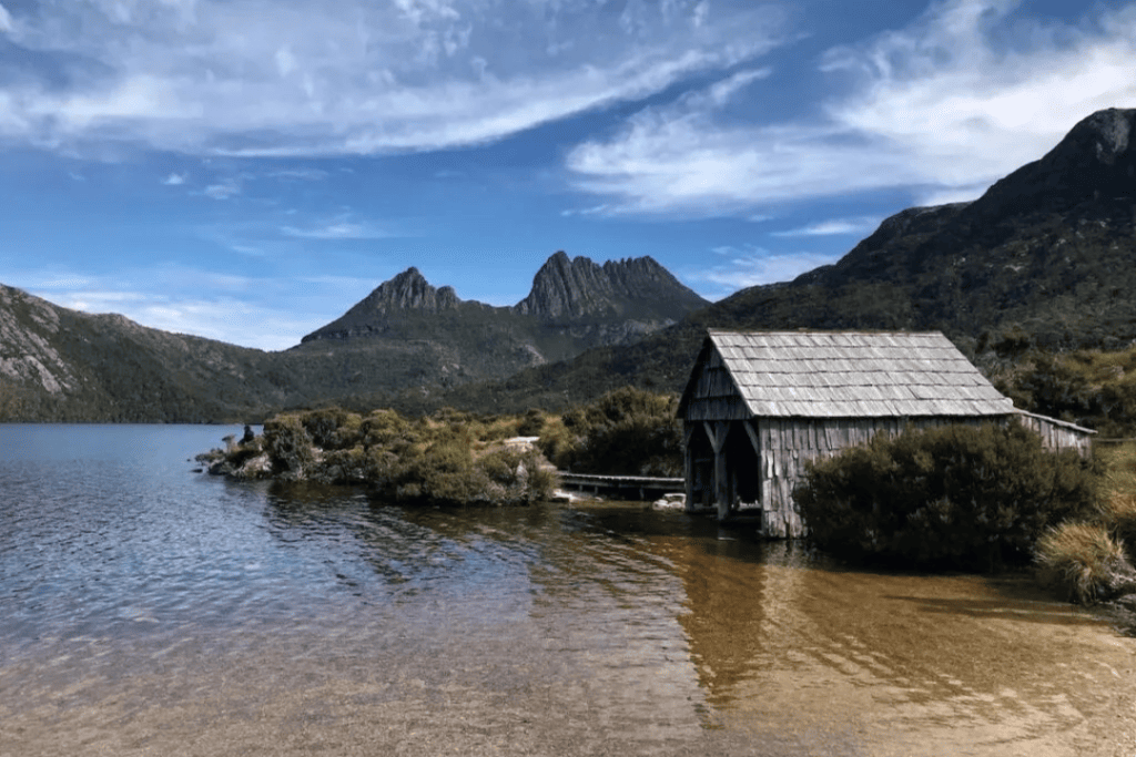
Dove Lake, Cradle Mountain-Lake St Clair National Park TAS
Surrounded by mountains and lush vegetation, the awe-inspiring Dove Lake is one of Tasmania’s most popular Australian lakes to visit. The wild and rugged Cradle Mountain towers above, serving as a scenic backdrop and reflecting off the water’s surface. The best way to explore is a journey along one of Tasmania’s nature walks. The Dove Lake Circuit Walk is a 5.6-kilometre loop trail around the lake with breathtaking scenery all along the way. The boardwalk-style path makes the hike suitable for all fitness levels. It takes two hours to complete – not including pit stops to soak in the views and highlights along the way.
On the east coast of Dove Lake, Glacier Rock displays striations parallel to the water that were caused by rocky debris within the glacier that carved out the basin as it moved through Cradle Mountain. The Ballroom Forest is a cool temperate rainforest with ancient myrtle-beech trees that grow above the moss-covered forest floor, creating a stunning cathedral effect. Stop for a photo at the rustic boat shed on the north-western shore, built in 1940 by Cradle Mountain’s first ranger.
discovertasmania.com.au/dove-lake

Lake Hillier, Goldfields-Esperance WA
Pretty in pink, Lake Hillier is on Middle Island in the Recherche Archipelago. Only 600 metres long and 250 metres wide, the lake’s fascinating colour makes up for what it lacks in size. Dunaliella salina is a type of microalgae that lives in the water, producing carotenoid pigment beta caroten. This, along with large quantities of halophilic bacteria and archaea within its salt crusts, is what gives the lake its bubblegum pink colour.
Although it was once used for salt extraction, the lake is now a big tourist attraction as it maintains its vibrant pink colour year-round. The surrounding island is remote and rather difficult to access, making it practically impossible for tourists to visit by ground. But that’s alright because Lake Hillier looks its best from an aerial perspective and, conveniently enough, Goldfields Air Services offers a 100-minute tour of the region. Only a strip of green island shoreline separates the pink lake from the turquoise waters of the Southern Ocean, deeply contrasting the unique look of this natural phenomenon.

Lake Argyle, East Kimberley WA
Formed in 1972 by the damming of the mighty Ord River, Lake Argyle is a beautiful place to visit. Holding 10.7 cubic kilometres of water at full supply – more than 18 times the size of Sydney Harbour – the scenery around this expansive lake is like no other. Known as the ‘Jewel of the Kimberley’ and surrounded by the Carr Boyd Ranges, this amazing marine environment is a paradise in the outback.
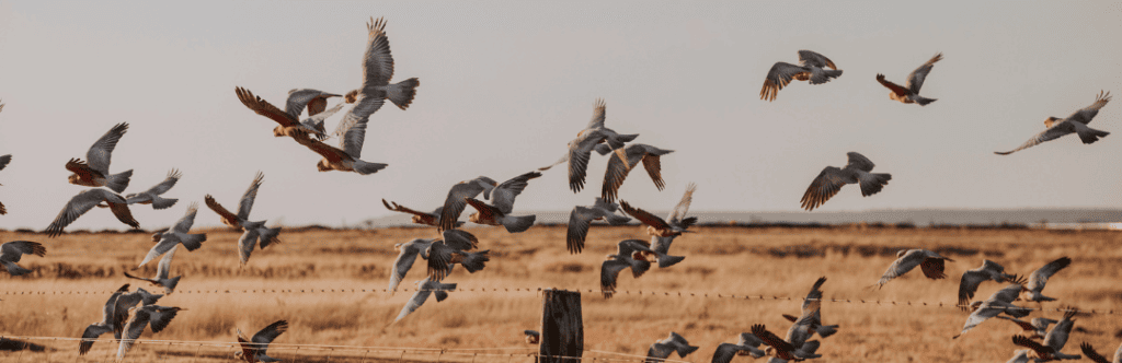
A wildlife cruise along the lake’s shoreline provides the opportunity for close encounters with freshwater crocodiles, fish, wallabies and more than 240 species of birds. In fact, it’s one of the most diverse Australian lakes when it comes to native flora and fauna. A huge network of bushwalking and mountain biking trails allow travellers to enjoy the tranquillity of the lake from afar. Lake Argyle is the perfect destination for a weekend of boating, waterskiing, fishing and general exploration. The Lake View Villas, Kimberley Cabins or the Lake Argyle Caravan Park provide a relaxing spots to stay the night.

Lake Eyre, Kati Thanda-Lake Eyre National Park SA
Approximately 15.2 metres below sea level, Lake Eyre, now officially known as Kati Thanda-Lake Eyre appears as a vast expanse of shimmering salt, stretching across the southern Australian outback. Located within the Kati Thanda-Lake Eyre National Park, the lake’s basin crosses four state and territory borders. It covers a sixth of the continent, making it one of the world’s largest internally draining river systems.
White salt takes the place of water, looking like a field of snow that meets the horizon in the desert. Lake Eyre usually contains little to no water, but approximately every eight years, heavy rains bring the place to life, inviting thousands of migratory birds for a pit stop. In the past 150 years, the lake has only filled to capacity three times.
You can book a flight above the salt lake or take the option to drive via the Oodnadatta Track. Camping is permitted in the park, allowing unparalleled stargazing without any light pollution. Halligan Bay Point campground, located directly on the lake’s shores, is the perfect place to immerse yourself in the outback.

Gippsland Lakes, East Gippsland VIC
Making up Australia’s biggest inland waterways, the Gippsland Lakes cover more than 600 square kilometres. The network of lakes, marshes and lagoons offer plenty of opportunity for exploration. The easily navigable waters are a boater’s dream. A haven for wildlife, the Gippsland Lakes are home to a unique population of dolphins, while allowing other bird and marine life to thrive. The many small islands rising above the water are accessible by ferry or water taxi.
Rotamah Island is inhabited by various bird species, kangaroos, wallabies and other native animals, while Raymond Island is home to a colony of koalas, so visitors can see these adorable creatures up close in the wild. The Mitchell River silt jetties are the longest of their kind in the Southern Hemisphere, stretching eight kilometres into the river. A geographical rarity, these jetties were naturally formed by silt deposits over thousands of years. Lakes National Park and Gippsland Lakes Coastal Park offer great spots to relax, unwind and enjoy the scenery of the region. It’s also full of great camping spots.

Myall Lakes, Myall Lakes National Park NSW
The Myall Lakes are a part of the region’s diverse ecosystem varying from coastal dunes to dense rainforest. Lake Myall National Park is a popular holiday and camping destination with activities that everyone in the family can enjoy. The waterways here are ideal for sailing, canoeing, kayaking, windsurfing, swimming and other water sports. Among the complex river and lake system, the region possesses 18 types of wetlands listed under the Ramsar Convention on Wetlands of International Importance.
Its one of the most popular Australian lakes for fishing with many great places to thrown in a line. With the proper bait and patience, you’ve a good chance to catch bream, whiting, Australian salmon, flathead or mullet. Visitors can explore the park and its ancient Aboriginal connections along the Mungo Walking Track. On the way you’ll pass various historic sites including the Dark Point Aboriginal Place. With scenic coastal views to Broughton Island, this site holds a great deal of cultural significance to the Worimi people. You can also check out the Mungo Rainforest Walk and enjoy a barbecue picnic in the park.
For more natural beauty to explore around the country, check out Our guide to Australia’s best nature and wildlife experiences.
Travel Australia with Rex
Rex flies all over the country. Book your flights here and check out the route map below for more inspo.